
Grand tour des écrins et de l'Oisans - GR 54 & variants - Personal development theme
05600 Guillestre
France
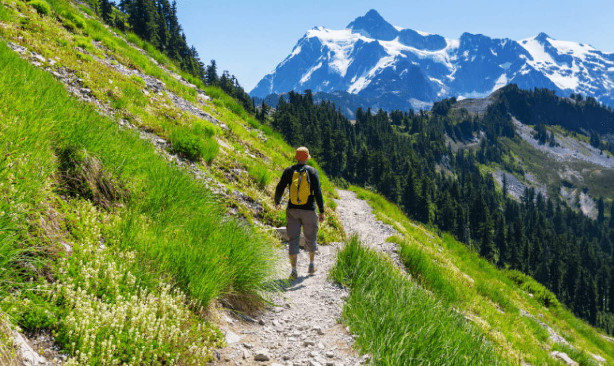
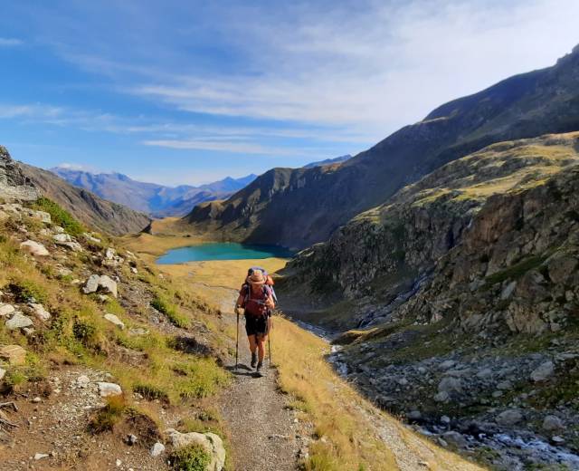
Discover the Écrins and Oisans on the paths and variants of the GR 54! Wild, sometimes alpine, this trek is suitable for good hikers and/or people in good physical condition with sure feet. Between magnificent mountain lakes, passes with sublime panoramas and varied landscapes, this beautiful itinerary is well worth the detour!
Together, we'll walk this beautiful trek, and along the way, we'll learn about personal development.
Personal development is a global approach to self-reflection and the valorization of one's potential, with the aim of improving the quality of one's life, one's relationship with others and the realization of one's deepest aspirations.
11-day stay with 1000mD+ per day (medium to difficult difficulty).
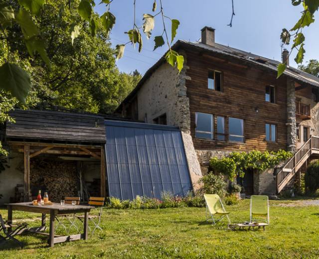
Accommodation: gîte, refuge, hotel
- Day 1
Debriefing at l'Argentière la Bessée 05120
- Day 1
Parking "Entre les Aigues" (1610 m) Col de l'Aup Martin (2908 m) refuge du Pré de la Chaumette (1783 m)
Ascent: 1170 m.
Negative altitude gain: 970 m.
Kilometers: 15 km. 6 h 30 walking time.
Lodging : Refuge.
Meals included: evening.
Meals on your own: morning & noon (picnic to be prepared the day before)
- Day 2
Refuge du Pré de la Chaumette (1783 m) Col de la Valette (2671 m) Col de Gouron (2591 m) Col de Vallonpierre (2607 m) Refuge de Vallonpierre (2271 m)
Ascent: 1190 m.
Negative altitude gain: 1000 m.
Kilometers: 12.5 km. 6h walking time.
Lodging: refuge.
Meals included: morning, noon,
- Day 3
Refuge de Vallonpierre (2271 m) Refuge de l'Olan (2344 m)
Ascent: 1250 m.
Negative altitude gain: 900 m.
Kilometers: 16.5 km. 7h30 walking time.
Lodging: Refuge.
Meals included: morning, noon, evening.
- Day 4
Refuge de l'Olan (2344 m) Pas de l'Olan (2683 m) Col de Colombes (2423 m) Col de la Vaurze (2500 m) Le désert en Valjouffrey (1250 m)
Ascent: 1050 m.
Negative altitude gain: 2100 m.
Kilometers: 17.5 km. 8h30 walking time
Lodging : gîte lodging : gîte d''étape.
Meals included: morning, noon, evening.
Meals included: morning, noon, evening.
- Day 5
Le désert en Valjouffrey (1250 m) Col de Côte Belle (2290 m) Valsenestre (1290m)
Ascent: 1020 m.
Negative ascent: 1000 m.
Kilometers: 9 km. 5h30 walking time.
Lodging: gîte d'étape.
Meals included: morning, noon, evening.
- Day 6
Valsenestre (1290 m) Col de la Muzelle (2613 m) Refuge de la Muzelle (2134 m)
Ascent: 1320 m.
Negative vertical drop: 540 m.
Kilometers: 9 km. 5h30 walking time.
Accommodation: refuge.
Meals included: morning, noon, evening.
- Day 7
Refuge de la Muzelle (2134 m) Cime du Pied de Barry (2637 m) Cascade de la Pisse (1185 m) Refuge Les Clots (1500 m)
Ascent: 780 m.
Negative altitude gain: 1460 m.
Kilometers: 11 km. 5h30 walking time.
Lodging: refuge.
Meals included: morning, noon, evening.
- Day 8
Les Clots refuge (1500 m) Plateau d'Emparis and Col du Souchet (2365 m) Le Chazelet (1777 m)
Ascent: 990 m.
Negative ascent: 730 m.
Kilometers: 15 km. 5h30 walking time.
Lodging: gîte d'étape.
Meals included: morning, noon, evening.
- Day 9
Le Chazelet (1777 m) La Grave (1472 m) Col d Arsine (2342 m) Le Casset (1550m)
Ascent: 940 m.
Negative altitude gain: 1220 m.
Kilometers: 22 km. 7h walking.
Lodging: gîte d'étape.
Meals included: morning, noon, evening.
- Day 10
Le Casset (1550 m) Col des Grangettes (2684 m) Lac de l'Eychauda (2539 m) Ailefroide (1510 m) Total ascent: 1200 m.
Negative altitude gain: 1200 m.
Kilometers: 19 km. 7h30 walking time.
Lodging: gîte d'étape.
Meals included: morning, noon, evening.
- Day 11
Ailefroide (1510 m) Col du Rascrouset (2799 m) Parking "Entre les Aigues" (1610m)
Ascent: 1300 m.
Negative altitude gain: 1200 m.
Kilometers: 13 km. 5h30 walking time.
Accommodation: self-catering not included.
Meals included: morning, noon.
Meals on your own: evening.
Rando Spirit, c'est aussi :

05600 Guillestre
France
05600 Guillestre
France
05600 Guillestre
France
05600 Guillestre
France
05600 Guillestre
France

05600 Guillestre
France

05600 Guillestre
France
D'autres merveilles dans le Parc national des Ecrins
Hameau de saint Alban
05380 Chateauroux-les-Alpes
France

72 chemin des Alaissies
38740 Valjouffrey
France

Lieu-dit Ventelon
L'Adrech
05320 La Grave
France