Guadeloupe National Park
81 L'ilet
97116 Pointe-Noire
Guadeloupe
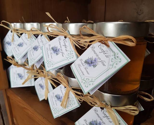
Gourd handbags from Tropik Eden
81 L'ilet
97116 Pointe-Noire
Guadeloupe

18 impasse SURCOUF
97442 Saint Philippe
France
Avenue Charles de Caqueray
06450 Saint Martin Vésubie
France

9 Avenue René Froger
05100 Briançon
France


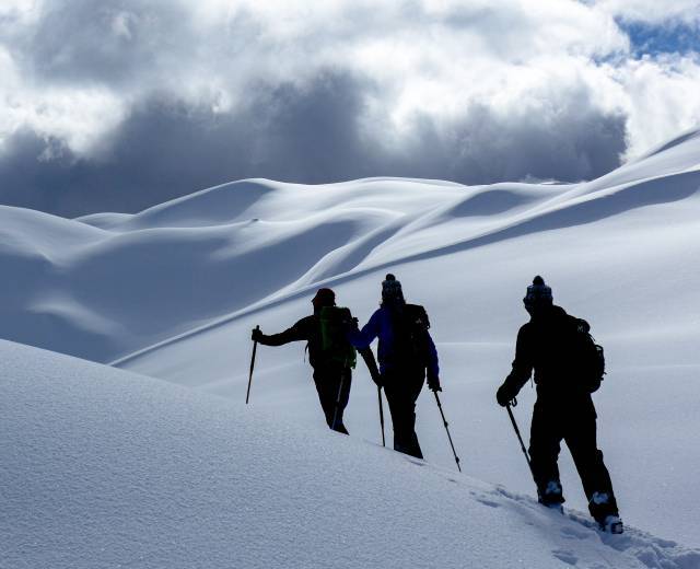
A sporty and wild trek. This 11 day itinerary follows the GR54 with some little frequented variants to meet the fauna and flora emblematic of the Ecrins National Park. Lodging in gites and mountain refuges carefully chosen for their comfort and authenticity.
The trip is currently available in 2 parts "Écrins Sud and Écrins Nord" to be done over 2 years!
11-day trek with over 100mD+ between 9 and 22km per day (difficult difficulty)
Elevation gain : 1170m,
Negative altitude gain: 970m
Kilometer: 15 km
Duration: 6h30
Meet at the Argentière-les-Ecrins SNCF train station at 8:30 a.m. for the overnight train from Paris. Transfer from the station to the Aygues bridge in the Entraigues valley.
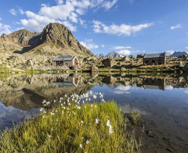
The start of our trek is surrounded by a large rocky cirque: a superb setting for our first steps into the heart of the Ecrins National Park. Ascent to Col de l'Aulp Martin (2761m) and Pas de la Cavale (2735m). Descent to the Pré de la Chaumette refuge for our first night in the mountains.
Elevation gain : 1190m
Negative altitude gain: 1000m
Kilometer: 12.5km
Duration: 6 hours
A day in a wild, mineral setting. We skirt around the Sirac ridge, crossing the Col de la Valette (2666m) then the Col de Gouiran (2697m) and finally the Col de Vallonpierre (2607m), which gives us access to the magnificent Valgaudemar valley.
Vertical rise positive: 1250m
Negative altitude gain: 900m
Kilometer: 16.5km
Duration: 7h15
Our day begins with a descent into the Séveraisse valley, following its banks to the pretty village of La Chapelle-en-Valgaudemar. In the afternoon, a steep but effective climb takes us straight to the refuge de l'Olan: a perch with an extraordinary view situated 1200m above the valley.
Vertical rise positive: 1050m
Negative altitude gain: 2100m
Kilometer: 17.5km
Duration: 8h30
A beautiful day on small trails at altitude. In the morning we climb to Pas de l'Olan (2683m) before crossing Côte Belle, followed by Col de Colombes (2400m). We then pass Lac du Lautier and Col des Clochettes (2183m) before a lunch break at the Refuge des Souffles. Last climb of the day to cross the Col de la Vauze (2500m) and descend to the village of Desert en Valjouffrey (1270m) for a well-deserved stopover.
Vertical rise positive : 1020m
Negative altitude gain: 1000m
Kilometer: 9km
Duration: 5h30
A day with less ascent today to recover from the big descents of the previous day. As we climb up to the Col de Côte Belle (2290m), the forest of the Combe du Cognet gradually gives way to alpine meadows and then to the orgues de Valjouffrey: an impressive stack of almost vertical laminated limestone strata. After the pass, the descent takes us to the pretty hamlet of Valsenestre (1300m), where we stop for the night.
Vertical rise positive: 1320m
Negative altitude gain: 540m
Kilometer: 9km
Duration: 5h30
A big climb awaits us this morning, with a fairly steep finish to the Col de la Muzelle (2613m). Lunch break at the pass before descending to Lac de la Muzelle: arrival in the early afternoon at this lakeside hut in an idyllic setting.
Vertical rise positive: 780m
Negative altitude gain: 1460m
Kilometer: 10.5km
Duration: 6 hours
From the refuge we leave the GR to climb a narrow path to the summit of the Cime du Pied de Barry (2637m). The descent is very attractive, on an open ridge. After the small hamlet of Lanchâtra, the thundering La Pisse waterfall refreshes us with its powerful natural mist. Transfer (45 minutes) to the Aymes parking lot, overlooking the Chambon dam (1300m). From here it's a short one-hour walk to our Les Clots hut (1510m).
Elevation gain : 990m
Negative altitude gain: 730m
Kilometer: 15km
Duration: 6 hours
A beautiful itinerary today, allowing us to contemplate the sheltered north faces of the massif while walking on gentle, undulating terrain. We pass by the beautiful petrifying fountain. The crossing of the Emparis plateau (2450m) offers us a bucolic day among alpine meadows and a myriad of small lakes. Descent to the pretty hamlet of Le Chazelet (1800m) on the edge of the plateau.
Vertical rise positive: 940m
Negative altitude gain: 1220m
Kilometer: 22km
Duration: 7 hours
On the descent from Le Chazelet, we regain contact with the Ecrins massif via the rocky lock overlooking the Pont d'Arsine (1667m). Lunch at the pretty little Chamoissière refuge.
Ascent to the Col d'Arsine (2340m), with its many lakes and winding river. Descent to the pretty village of Le Casset (1500m).
Vertical rise positive: 1200m
Negative altitude gain: 1200m
Kilometer: 19km
Duration: 7h30
From Casset up the Grand Tabuc valley, then the Montagnole valley to the Col des Grangettes (2684m) and Eychauda lake below. Lunch break by the lake before descending to Ailefroide via the Vallon de Chambran.
Vertical rise positive : 1300m
Negative altitude gain: 1180m
Kilometer: 13km
Duration: 5h30
A last beautiful day in a wild valley to finish this great Tour de l'Oisans et des Ecrins: we climb up the Clapouse valley on small paths to the Collet du Rascrouset (2799m). Last panoramic views of the Ecrins peaks, then back to the Entraigues valley... back to the starting point, the loop is complete!
Transfer to the Argentière-les-Ecrins SNCF train station mid-afternoon.
If you would like to book in 2 instalments, please contact the guide directly!
Price of adult stay : 1210 €

9 Avenue René Froger
05100 Briançon
France
9 Avenue René Froger
05100 Briançon
France

9 Avenue René Froger
05100 Briançon
France
05800 La Chapelle-en-Valgaudémar
France
Maison Reynier
Pont du Fossé
05260 St-Jean-St-Nicolas
France